Welcome!
Few Pennsylvania rivers can claim to be as wild or scenic as the Allegheny, and the Allegheny River Trail offers hikers and bikers access to more than 30 miles of the waterway’s flat and forested banks. This trail, which consists almost entirely of smooth asphalt, makes its way south through the old oil country of northwest Pennsylvania. Along the way, a variety of man-made monuments attest to the region’s long history, while wildlife ranging from deer to chipmunks to eagles add to the sense of natural immersion.
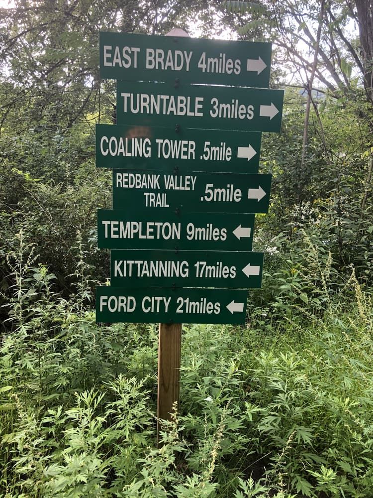
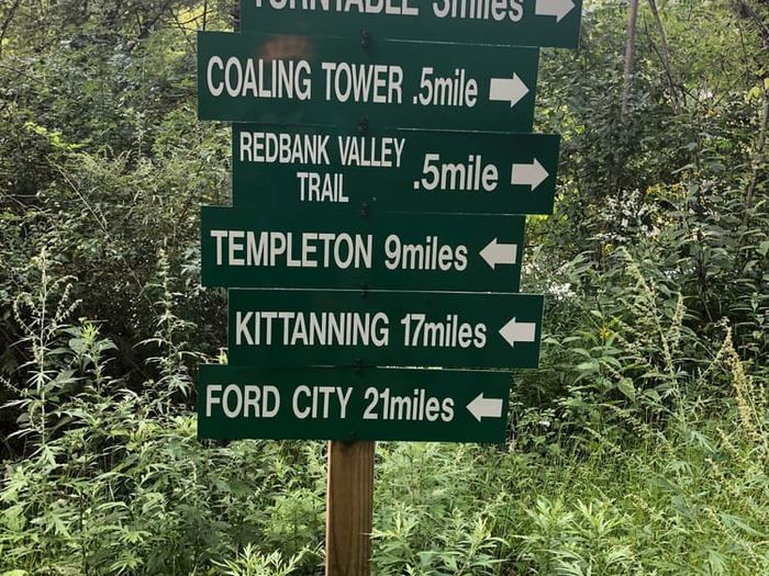
For a complete north-to-south journey, you’ll begin in the city of Franklin, the Venango County seat. This riverside municipality’s motto is “always eventful,” so be sure to check out all that the city has to offer before heading south on the Allegheny River Trail. You’ll swiftly come upon numerous testaments to the oil-driven history of the area, including an 1864 oil well that was partially owned by notorious assassin John Wilkes Booth. Further south, you can stop at the pedestrian-only Belmar Bridge, which stretches 1,385 feet across the Allegheny; it offers some impressive views of the surrounding valley, so you may want to bring a camera. Not far downstream is Indian God Rock, a historic boulder with Native American carvings dating back as far as 1200 A.D. Unfortunately, the site has been somewhat degraded by vandalism, but you may still be able to spot some petroglyphs. South of the rock is Kennerdell, where you’ll transition to a hillier half-mile stretch of rugged gravel-and-dirt road before returning to pavement. The section of trail around Kennerdell also features two railroad tunnels: the 3,350-foot Kennerdell Tunnel and the 2,868-foot Rockland Tunnel. After the latter tunnel, the path heads the rest of the way to Emlenton, where it appears to end. However, after a 3-mile gap (which can be bridged by walking or biking alongside PA-268), the trail continues for 3 more miles between Foxburg and Parkers Landing. This disconnected stretch features a crossing over the Clarion River, as well as the Parker Bridge.
The Allegheny River Trail follows the abandoned bed of the Allegheny Valley Railroad (AVR), an essential means of transporting oil and other commodities that opened in 1855. It was purchased by the Pennsylvania Railroad and became the Buffalo and Allegheny Division in 1900, then continued to operate until 1984, at which point part of the line was donated to the Allegheny Valley Trails Associations. The Allegheny’s railroad history is also reflected by many other local trails. In Franklin, the Samuel Justus Trail picks up where the Allegheny River Trail leaves off and heads further north along the AVR grade; meanwhile, Armstrong Trails occupies a more southern section of the former rail line in Armstrong County. Additionally, the Sandy Creek Trail travels east-west along the old path of the Jamestown, Franklin and Clearfield Railroad, thus intersecting the Allegheny River Trail at the Belmar Bridge. Other local recreation sites include the Rockland Furnace and Freedom Falls, both of which can be accessed via a short gravel road near the Rockland Tunnel.
Trail specifications: The trail is approximately 8 feet in width.
Caution: Both tunnels are not well-lit and contain bends that prevent light from reaching the whole way through. For your own safety, bring a flashlight or headlamp.
Camping: Camping is permitted along the trailside. Be sure to practice Leave No Trace and camp respectfully.
Accessibility: Though the trail is wheelchair accessible for most of its length, the half-mile gravel-and-dirt section near Kennerdell (in the community of Sunny Slope) may present a challenge for those with limited mobility.
This trail is managed by the Allegheny Valley Trails Associations. For more information, visit the Allegheny Valley Trails Website. Contact the Allegheny Valley Trail Associations at avta@clarion.edu.
Franklin (northern terminus): From Franklin, take 8th Street east across the Allegheny River. After crossing, continue on US-322 East for 0.2 mile. Parking will be on the right, marked by a sign for the Allegheny River and Justus Trails.
Brandon: From US-322 (in Venango County), turn south onto Rockland Road and continue for 4.4 miles. Turn right onto Coal City Road (which becomes Brandon Road) and continue for 6.5 miles. Parking will be at the end of Brandon Road.
Rockland Station: From US-322 (in Venango County), turn south onto Rockland Road (which becomes Pittsville Road) and continue for 7.3 miles. Turn right onto Rockland Station Road and continue for 1.8 miles to the trailhead, which will be near the north end of the Rockland Tunnel.
Emlenton: From I-80 (heading east in Clarion County), take Exit 45 to get on PA-478. Turn left onto PA-478, then take the first left onto PA-208 West and continue for 2.1 miles. In Emlenton, continue straight onto Main Street until it ends. The trailhead will be at the end of Main Street.
Foxburg: From I-80 (heading east in Clarion County), take Exit 45 to get on PA-478. Turn right on PA-478 and continue for 1.9 miles. In Saint Petersburg, turn right onto PA-58 West and continue for 2.3 miles. In Foxburg, turn left onto Main Street and continue straight to parking.
Parker (southern terminus): From I-80 (heading east in Clarion County), take Exit 45 to get on PA-478. Turn right on PA-478 and continue for 1.9 miles. In Saint Petersburg, turn right onto PA-58 West and continue for 2.5 miles. Turn left onto PA-268 South and continue for 2.6 miles. In Parker, turn left onto the Parker Bridge and continue for 0.3 mile. Immediately after the bridge, turn left onto the dirt road, which leads to parking underneath the bridge.