Welcome!
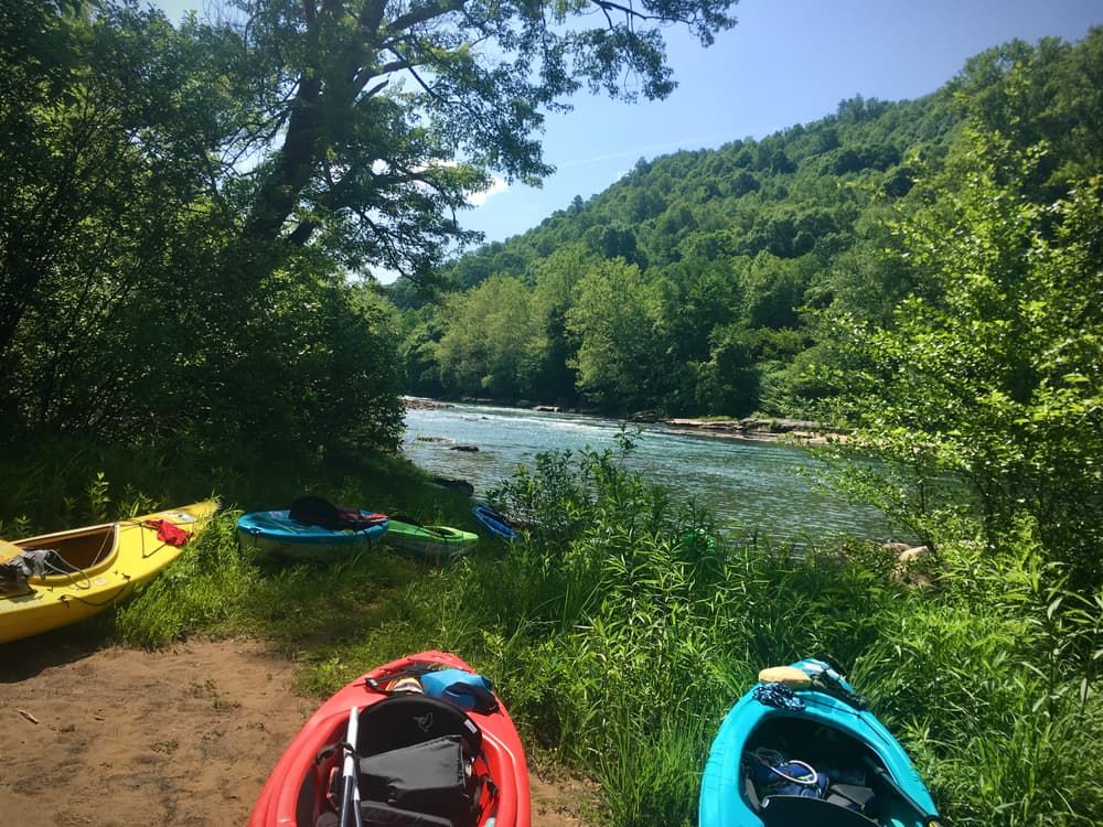
The comeback story of the Conemaugh and Kiskiminetas (“Kiski”) Rivers is almost unbelievable. Once so polluted that they “ran red,” the connected waterways are now gorgeous and pure, home to diverse fish populations and surrounded by abundant flora and fauna. Paddlers will get the chance to witness this spectacular recovery as you paddle downstream from near Johnstown in the east to Freeport in the west. Enjoy peaceful river speeds of 2 to 3 miles per hour as you float through the Conemaugh River’s gradual 2,000-mile descent, then follow the Kiski all the way to its junction with the Allegheny River. Along the way, keep your eyes peeled for birds like eagles and herons, wildlife ranging from otters to black bears, and forests of towering hardwoods. Plus, bring a fishing pole and take advantage of the thriving bass, perch, and occasional clusters of trout that lurk beneath the waters.
Beginning in Somerset County, just south of Johnstown, the Conemaugh River quickly reaches the Cambria County city. As you pass through Johnstown, you’ll be able to spot a number of fascinating landmarks; the Johnstown Inclined Plane is the steepest vehicular plane in the world, while the Conemaugh River Bridge famously caught fire during the Johnstown Flood of 1889. Coming out of Johnstown, the Conemaugh slices between Gallitzin State Forest and Laurel Ridge State Park before beginning to curve west at Findley Run. This is the site of some exciting Class II and III rapids, as well as the 1,560-foot-deep Conemaugh Gorge, which ranks among the deepest water gorges in the state. More Class II and III rapids await you at Richards Run in Robinson, and then you’ll pass through the 1,308-foot-deep Packsaddle Gap. The town of Blairsville greets you shortly before the halfway point, and then it’s on to Saltsburg. Unfortunately, you can’t actually paddle straight from Blairsville to Saltsburg; the impassible Conemaugh Dam sits between them. Regardless, Saltsburg is still a worthwhile destination. Aside from hosting the historical Canal Park walkway, it’s also where the Conemaugh River merges with Loyalhanna Creek to become the Kiski. From there, the Kiski flows west through a chain of river towns: Avonmore, Apollo, Vandergrift, Leechburg, and finally Freeport. In Freeport, the Kiski feeds into the Allegheny River, marking the end of your Kiski-Conemaugh journey.
The tale of the Conemaugh and Kiskiminetas Rivers goes as far back as prehistoric times, when Monongahela Native Americans roamed the riverside. They were followed by other native peoples, including the Seneca, Delaware, and Shawnee. It’s from these early inhabitants that the rivers get their names; “Conemaugh” comes from a Native word for “otter,” whereas “Kiskiminetas” has been loosely translated as “make daylight” or “cut spirit.” Native American tribes also established a network of footpaths throughout the region, with the Kuskusky Path and Kiskiminetas Trail meeting in modern-day Apollo. As white settlers began to flood the region, however, a new form of transportation took hold: the Main Line Canal, which connected Harrisburg in the east and Pittsburgh in the west. The Kiski-Conemaugh route served as an important part of the canal, as the many ruins of canal locks along its banks attest. The rivers’ economic impact helped to develop the region throughout the nineteenth and twentieth centuries, but it came at a cost. Industrial pollution devastated the waterways; in fact, the damage was so bad that an environmental survey was unable to find any fish in the Conemaugh in 1980, and the Kiski’s pH was similar to that of beer in 1993. Since then, however, a dramatic recovery led by dedicated conservationists has restored the natural beauty of the route. Knowing how far the Kiski-Conemaugh Water Trail has come makes paddling it all the more enjoyable.
Seasons: The water trail is open year-round, but river depth is typically at its lowest in July and August. During these months, be sure to check water levels before paddling.
Dams: There are two dams, located at river mile 68 (near Seward) and river mile 66 (near New Florence), that can be conveniently portaged. However, the Conemaugh Dam, at river mile 35 (near Saltsburg) is impassible and cannot be portaged. Be aware of all three dams and use caution if paddling near these river miles.
Rapids: Note that there are Class II and III rapids at river mile 71.7 (near Seward) and 57.2 (near Robinson).
This trail is managed by the Allegheny Ridge Corporation. For more information, visit Main Line Canal Greenway Website. Contact the Allegheny Ridge Corporation at info@alleghenyridge.org.
Greenhouse Park (Johnstown): From Johnstown, take Napoleon Street south for 0.8 mile. Turn right onto Franklin Street and continue for 3.2 miles. Turn left onto Old Country Road and continue for 0.2 mile. Go straight through the intersection to get on Tire Hill Road and continue for 0.8 mile. Parking will be on the left, at Greenhouse Park.
Saltsburg Boat Launch: Located in Saltsburg. At the corner of Salt Street and Point Street, go west on Point Street. When Point Street ends, parking will be straight ahead, across Water Street.
Roaring Run Boat Launch (Apollo): From Apollo, take Kiski Avenue south for 0.8 mile. Keep right onto Canal Road and continue for 0.5 mile. Parking will be on the right.
Leechburg: Located in Leechburg. At the corner of Market Street and 1st Street, go south on 1st Street. The access point will be at the end of 1st Street. There is no specified parking area, so you may need to park beside the street. Be sure that you are not blocking the ramp or the road.