Welcome!
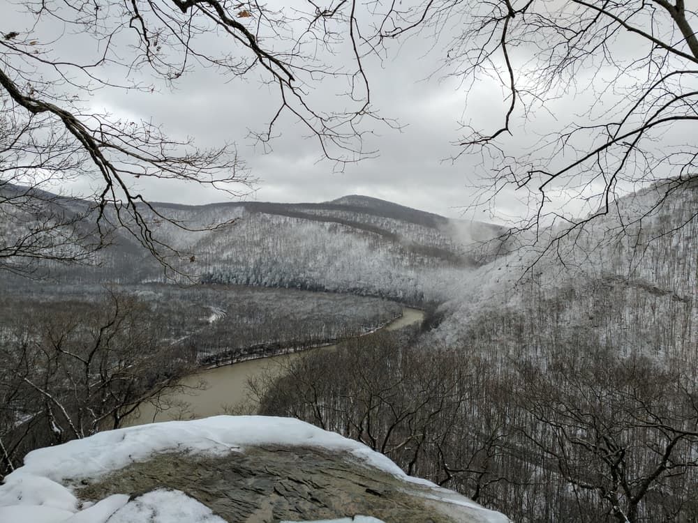
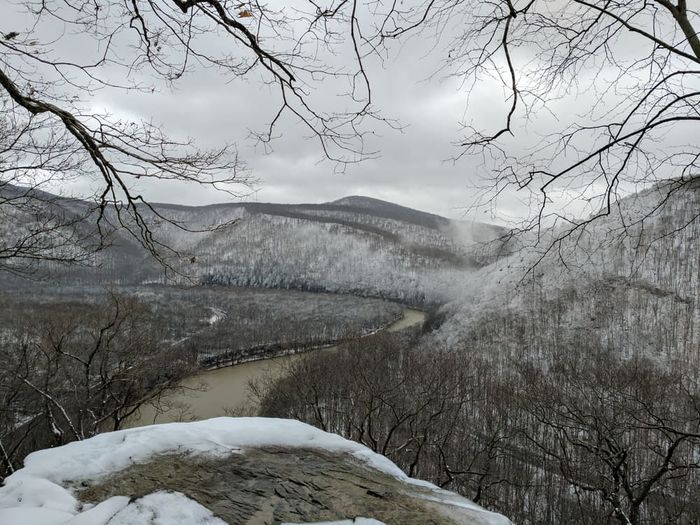
The Laurel Highlands Hiking Trail (LHHT) is a challenging, 70-mile, yellow blazed hiking trail located in the beautiful Laurel Highlands area of Pennsylvania. It showcases some of the best and most sought-after views the state has to offer. The trail starts near Johnstown, PA in Conemaugh Gorge and makes its way south along Laurel Ridge until Ohiopyle State Park, where the trail ends.
The LHHT can be hiked in as little as 24 hours. There's even an LHHT Ultra-Marathon every first Saturday of June, where runners complete the trail in less than a day, but it is recommended to plan for at least a 2-4 day hike on the trail.
The LHHT is open year-round, but it is recommended to hike the trail during warm and/or dry months.
From Johnstown: The LHHT starts in the Conemaugh Gorge. From here the trail makes its way over Irwin Hill, Sugar Camp Hill and Mystery Hill, some of the highest peaks in Pennsylvania.
The LHHT ends with a more rugged section of the trail in Ohiopyle State Park, home to many waterfalls and a natural water slide. Hikers should take some time to relax in this natural environment after a long and arduous trek.
Water: As of 2014, water is again available at all shelter areas, although it is non-potable. There are three potable locations: Mile 26 (just south of Seven Springs), the old Laurel Ridge State Park Office (along Route 653), and at the Route 653 trailhead parking lot. All other water must be boiled, treated, or filtered.
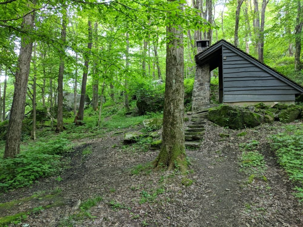
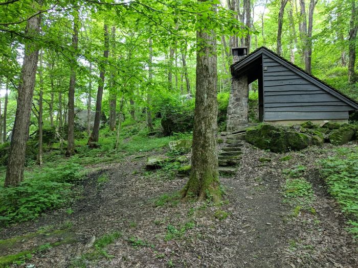
Camping: There are 8 camping sites along the trail located every 6-12 miles that are usually stocked with basic supplies for hikers. Each shelter has five open-faced lean-to structures for campers. Permits list maximum occupancy of shelter sites as 5. Some shelters have tent areas marked with wooden beams and gravel (Grindle Ridge), but most are just grassy areas. Camping reservations must be made ahead of time. Going rate is about $4/person per night for PA residents and $5/person per night for non-PA residents. To do so, call 412-455-3744 or visit https://pennsylvaniastateparks.reserveamerica.com/.
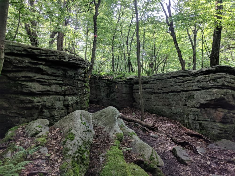
Wildlife: Although there are many opportunities to see both flora and fauna natural to Pennsylvania along the trail (especially in Spring), it's important to be wary of the dangers posed by wildlife present on the trail and in Western Pennsylvania. Bears do live on the trail. Pennsylvania bears are usually pretty easily frightened-off, and Laurel Ridge State Park has not had any nuisance-bear incidents, so as long as hikers take care to hang their food, there should be no issues. Rattlesnakes are another animal of concern along the trail. They can be seen sunning themselves on Laurel Ridge between Seward and Ohiopyle on warm sunny days. They are poisonous, but only attack when threatened. Rattlesnakes use their distinct rattle noise as a warning when threatened, but hikers should not use this as the only warning. Hikers should take notice of the trail ahead and keep an eye out for these critters, especially in sections with direct sun exposure and rocks. One of the biggest human threats from animals on the LHHT is from ticks. They are abundant throughout the trail and it is recommended to wear long sleaves and pants, or avoid contact with plants and stay on the trail.
The Laurel Highlands Hiking Trail is managed by the Laurel Ridge State Park Complex team. Hikers can contact them at (814) 445-7725 or laurelridgesp@pa.gov for help planning their hike. More information is available at golaurelhighlands.com
Conemaugh Gorge (Northern Terminus): Following PA Route 56 East past the town of Seward, make a right on Trail Head Drive towards Big Spring Reservoir in Charles F. Lewis Natural Area. The trailhead is on the left with Big Spring Reservoir itself on the left as well.
Ohiopyle State Park (Southern Terminus): From PA Route 381 Southbound. Coming into Ohiopyle, make a right before the bridge over the Youghiogheny River. This is where the Laurel Highland Hiking Trail ends and the Great Allegheny Passage. This parking lot can be used for both trails. The outfitters at the trailhead, Wilderness Voyageurs, runs a shuttle service ($170) which lets hikers drop supplies at trailheads and take one last Sheetz run.
Lincoln Highway (US Route 30): On 30 Eastbound. About 10 miles after Ligonier, make a right on Mink Road. There is an accessible parking lot alongside Route 30.