Welcome!
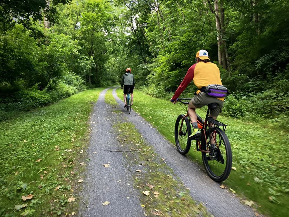
The Lower Trail is full of contradictions. For one thing, it’s not pronounced how you think it is; in this case, “Lower” actually rhymes with “flower.” For another, the trail’s seemingly obscure location–along the Frankstown Branch of the Juniata River–was once a crucial location for trade and commerce in the state of Pennsylvania.
The Juniata River’s economic potential was first explored during the 1830s, when it became a major component of the Main Line Canal, which allowed for more efficient trade between Philadelphia and Pittsburgh. Though the canal was destroyed by flooding in the 1870s, it was soon replaced by a new section of the Pennsylvania Railroad, which operated along the Frankstown Branch until this too became obsolete in 1979. With both the canal and railroad now gone, all that remains is a secluded forest dotted with reminders of past development. Former canal locks, old stone quarries, and even an iron plantation at Mount Etna can be found along the Lower Trail. These industrial features form a striking contrast with the trail’s natural diversity, which includes such impressive creatures as bald eagles and osprey. In fact, part of the trail has been designated as an Important Birding Area (IBA) by the Audubon Society.
The Lower’s transformation from abandoned railroad to nature trail was only possible through the efforts of the Rails to Trails of Central Pennsylvania and a generous donation from T. Dean Lower, who's late wife and son the project is now named after. The result is a smooth, flat trail of crushed stone that is accessible to virtually anyone. Visitors can make their way through the Lower’s six “stations,” as the trailheads are commonly known: Alfarata, Mt. Etna, Covedale, Williamsburg, Grannas, and Flowing Spring.
Just like the canal and railroad that preceded it, the Lower Trail is also a small component of a much larger system: the Mid State Trail, which runs through the entirety of Pennsylvania from north to south has connections near the Alfarata and Grannas stations allow long-distance hikers to continue their cross-state journey. The trail is also a segment of the 9/11 Memorial Trail, and will soon be connected to Canoe Creek State Park.
This trail is managed by Rails to Trails of Central Pennsylvania. For more information, visit the Rails to Trails of Central Pennsylvania Website. Contact the Rails to Trails of Central Pennsylvania at webhost@rttcpa.org.
Alfarata Station: From Alexandria, take Bridge Street south 0.4 mile. Turn right onto Loop Road, then right onto US-22 West, and continue for 1.6 miles. The trailhead will be on the right.
Mount Etna Station: From US-22 (in Blair County), turn southeast onto Fox Run Road and continue for 2.2 miles. The trailhead will be on the left.
Covedale Station: From Williamsburg, take High Street north for 1 mile. Turn right onto Fox Run Road and continue for 2 miles. Turn right onto T545 and continue for 0.7 mile. The trailhead will be on the right.
Williamsburg Station: Located in downtown Williamsburg, at the corner of East 1st Street and Liberty Street.
Grannas Station: From Williamsburg, take PA-866 north for 1.6 miles. Turn left onto Lower Piney Creek Road. The trailhead will be on the right.
Flowing Spring Station: From US-22 (in Blair County), turn south onto Flowing Springs Road and continue for 0.3 mile. Continue straight onto Long Road. The trailhead will be on the right.