Welcome!
Pittsburgh’s Montour Trail has a history of going above and beyond. It is the longest suburban rail trail in the United States, totaling almost 60 miles in its full scope. The Montour is also award-winning, honored as the Pennsylvania Trail of the Year in 2017. That’s no surprise, considering the abundance of tunnels, bridges, and connectors that make every trip on the Montour a true adventure.
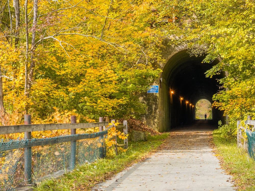
Beginning at the riverside suburb of Moon Township, the Montour tracks south and west, passing through the 575-foot Enlow Tunnel. After Enlow the trail comes to its first junction, where the Airport Connector (a mix of trail and on-road) travels an additional 6.3 miles to Pittsburgh International Airport. This means that cyclists can conveniently access the trail straight from the airport. Meanwhile, the main path continues southward into McDonald, the location of a bridge that’s almost 1,000 feet long. South of McDonald, the trail begins to curve more toward the east. There’s also another junction, as the Westland Branch (4.1 miles long) splits off to follow its own peaceful, countryside route. As the Montour heads further and further east, the trail passes through the 600-foot National Tunnel. Just east of the paved Arrowhead trail section, users can turn onto the Bethel Branch (2.8 miles). Be aware that the Montour Trail has on-road segments between MP 39.5 – 44.5. There are two 10 plus mile segments that have no road crossings; MP8-21 (Imperial to Galati) and MP 24-35 (Cowden to Library). The southeast end of the trail is at MP 46.5 in Clairton.
The Montour Trail follows the rights-of-way of the old Montour Railroad, a small but significant railway that once carried coal from as many as 27 mines in the Pittsburgh area. The railroad was engineered to allow no grade over 2% and was successful because of its location, allowing access to many of the state’s major railroads. Similarly, the Montour Trail connects to some of Pennsylvania’s most impressive trails. Near the bridge in McDonald, an intersection with the Panhandle Trail allows visitors to take a detour as far as West Virginia. And at the eastern end of the Montour, a 5-mile Clairton Connector (on-road) links up to the Great Allegheny Passage, which stretches almost 150 miles and can take users as far as Washington, D.C. when combined with the C&O Canal Towpath. Plus, further connections are coming, with work currently in progress on the Coraopolis, Muse, and Southpointe Connectors. All in all, the Montour ties together a vast network of trails–in Pennsylvania and beyond.
Hours: The Montour Trail remains open from dawn to dusk.
No hunting is permitted on the trail and most adjacent property is private.
Width: The trail width is roughly 8 feet.
GIS data available thanks to the Montour Trail Council IT/GIS Committee.
This trail is managed by the Montour Trail Council. For more information, visit the Montour Trail Website. Contact the Montour Trail Council at mtcoffice@montourtrail.org.
Montour Road (Coraopolis): From Coraopolis, head southeast on 5th Avenue. Turn left onto State Avenue and continue for 0.7 mile. Take a slight left onto Montour Coketown Road and continue for 0.1 mile. The trailhead will be on your left.
Clairton: From Clairton, head east on Saint Claire Avenue for 0.4 mile. Turn left onto North State Street and continue for 1.2 miles. Turn left onto Mendelsohn Avenue. The trailhead will be on your left.