Welcome!
The Schuylkill (pronounced SKOO-kil) River Trail has not yet reached its ambitious end goal of 120 miles, but this developing rail trail is already one of Pennsylvania’s finest. In fact, USA Today lauded it as America’s best urban trail in 2015, and the Rails-to-Trails Conservancy considered it one of the “Top 10 Trails in Pennsylvania.” To receive such honors before it is even finished, the trail—currently around 80 miles in length—must be doing something right. Perhaps it’s the location, situated along the banks of the mighty Schuylkill River between Philadelphia and Frackville. Perhaps it’s the diversity of scenery, ranging from the Philly skyline to open farmland to suburban neighborhoods. Or perhaps it’s something else entirely; you’ll never know unless you try it for yourself!
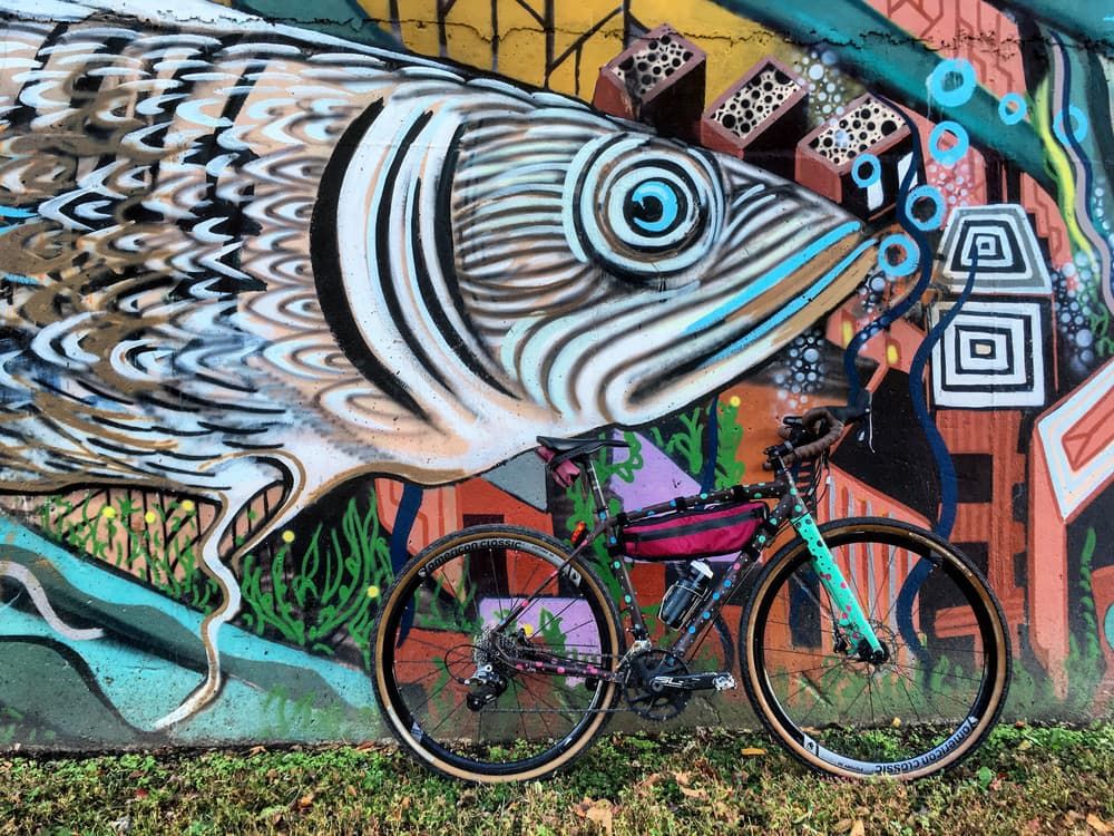
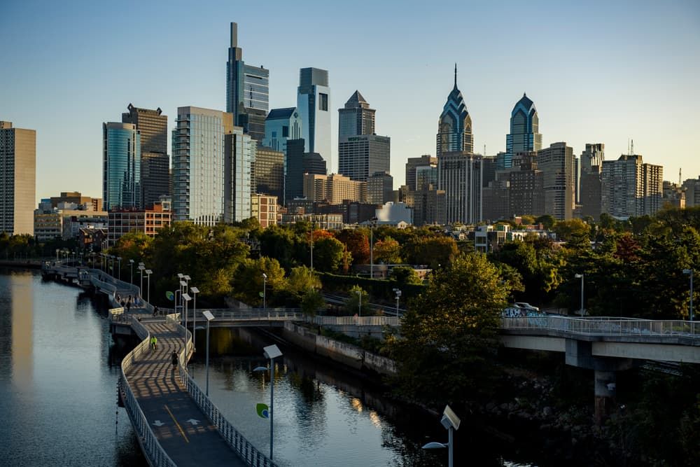
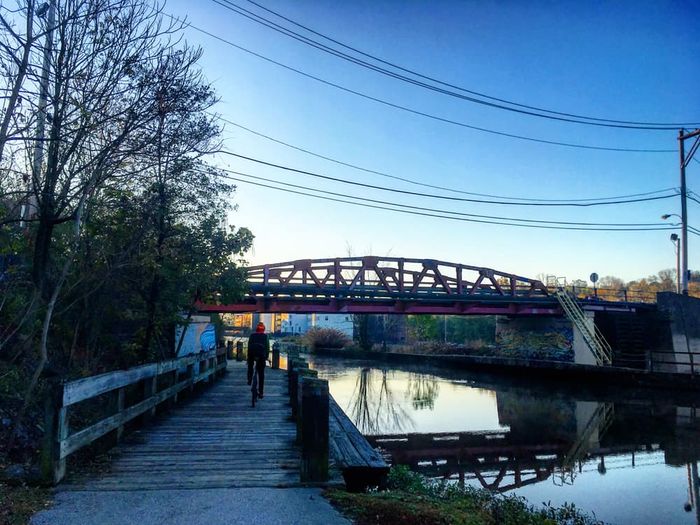
For the longest continuous stretch of trail, begin from the south, in the heart of Philadelphia at the Schuylkill Banks trailhead. This site features a 2,000-foot boardwalk along the riverside, which may be how you want to begin your trek. Philly also holds plenty of other attractions right along the trailside, including the iconic “Rocky steps” at the Philadelphia Museum of Art and Bartram’s Garden, the oldest botanical garden on the continent. As you travel north and west, the neighborhood of Manayunk offers some delicious eateries, while Valley Forge is a historic Revolutionary War encampment with plenty of monuments and educational exhibits. You’ll pass by some of the river’s only preserved canal remnants below Phoenixville, then make a brief departure from the Schuylkill to follow French Creek. Returning to the riverside, you can proceed to Parker Ford, and it is here (around mile 37) where the first break in the trail occurs. Parker Ford also holds the (supposedly) haunted Pennhurst Asylum and an eighteenth-century tavern where George Washington (allegedly) stayed.
The trail picks up again in Pottstown, which is just a short drive away on PA-724; from here, a continuous 19-mile section known as the Thun Trail brings you further northwest to the city of Reading. The Thun Trail stretch is well-shaded, and it features three river crossings and some of the corridor’s most notable railroad remains. Unfortunately, the trail only gets more fragmented after Reading, but you can still use a marked on-road path to get to the outskirts of Hamburg, a quaint little town known for its Pennsylvania Dutch roots. North of here, a crushed-stone segment known as the Bartram Trail continues onward for around 7 miles, featuring a crossing with the Appalachian Trail before it too devolves into a jumble of partially completed segments. These eventually culminate in Frackville, where the trails of State Game Lands 326 offer further opportunities to explore. At the end of the day, however, you’ll likely want to stick to the southern sections of trail for a smooth, uninterrupted journey.
The Schuylkill River takes its name from a Dutch word meaning “hidden river,” but its history begins long before Europeans ever saw its waters. The area around what is now Philadelphia was originally inhabited for thousands of years by the Lenni Lenape Native Americans, who were pushed away as white settlers began to arrive in the late 1600s. Under these new inhabitants, the Schuylkill River became a canal route in the 1810s, carrying coal to the industrial centers in Philly. The canal’s era of dominance, however, was short-lived; the rise of the Reading Railroad (originally called the Philadelphia and Reading) in the 1840s brought a new transportation infrastructure to the region. For years, the banks of the Schuylkill witnessed a bitter rivalry between the Reading and the Pennsylvania Railroad, which constructed a branch of its own along the riverside. The Pennsylvania Railroad’s Schuylkill Valley Division was never as successful as the Reading, and most of its tracks were eventually abandoned. When the Schuylkill River Greenway Association was established in 1974, this organization began the process of transforming the old railroad grade into a continuous 120-mile hiking-and-biking path. That’s a project that’s still ongoing today.
Hours: The trail remains open from dawn to dusk.
Hunting: The Schuylkill River Trail passes through areas where hunting is permitted during appropriate seasons. For your own safety, wear orange if using the trail during these times. Visit the PA Game Commission Website for more information on hunting seasons.
For equestrians: Horseback riding is permitted in Berks and Schuylkill Counties (everything northwest of Pottstown).
Management: Different sections of trail fall under different jurisdictions, and rules and regulations may differ slightly depending on location. For more information, visit the Trail Partners Page.
This trail is managed by a group of organizations known as the Schuylkill River Trail Partners. The Schuylkill River Greenway Association is the primary manager and is responsible for the sections of trail in Berks and Schuylkill Counties. For more information, visit the Schuylkill River Greenways Website. Contact Schuylkill River Greenways at info@schuylkillriver.org.
Schuylkill Banks (southwestern terminus): Located in Philadelphia. From downtown Philly, follow Walnut Street west until it reaches a bridge over the Schuylkill River. The trailhead is directly under the bridge, on the east side of the river. There is no parking here, so you’ll have to park somewhere else and walk to the trailhead. Proceed north for a continuous path to Parker Ford.
Parker Ford: From Spring City, take Bridge Street west for 1 mile. Turn right onto PA-724 and continue for 1.5 miles. Turn right onto Linfield Road. Parking will be immediately on the left. Proceed southeast for a continuous path to Schuylkill Banks.
Pottstown Riverfront Park: Located in Downtown Pottstown. At the corner of East High Street and South Hanover Street, go south on Hanover Street for 0.2 mile. Turn right onto College Drive. Parking will be on the left, across the train tracks at Pottstown’s Riverfront Park. Proceed west for a continuous path to Reading.
Reading Riverfront Park: Located in Reading. At the corner of Franklin Street and 2nd Street, go west on Franklin Street. The trailhead will be on the right, at Reading’s Riverfront Park. Proceed south for a continuous path to Pottstown, or proceed north along the marked on-street path to Hamburg.
Yarnell Park: From Hamburg, take Old US-22 west to cross the Schuylkill River. After crossing, continue on Old US-22 for 0.7 mile. Turn left onto Berne Road and continue for 1.8 miles. Turn left onto Fisher Dam Road and continue for 0.3 mile. Turn right onto Water Street. The trailhead will be on the right. Proceed south along the marked on-street path to Reading.
Reading Railroad Heritage Museum: Located in Hamburg, near the corner of Arch Street and South 3rd Street. Proceed north along the marked on-road path towards the Bartram Trail.